![]()
|
|
Area 51 is located outside of
Las Vegas, Nevada. According to official United States governmental
statements, the base doesn’t actually exist. Unofficially, it is an
operational testing range for the cutting edge technological developments of
America’s armed forces. The facilities centered around the Groom Lake area
are the most secretive in the world, requiring a level of security so
remarkable that Area 51 has become a modern day myth. Access to the base is by authorized personnel only, via a daily shuttle service from Las Vegas aboard a Boeing 747. There is no perimeter fence, just vast mileage of desert in all directions making this |
|
inaccessible to the public. This
‘no man’s land’ around Groom Lake is patrolled constantly by the infamous "Camo-dudes",
supported by electronic surveillance, military units and air support.
Warning signs on the edge of Area 51 tell of heavy penalties for intruders,
including the authorization for the deadly use of force. The U.S.
Government aims to keep this site secure at all costs. No one gets in -
period.
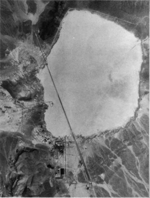
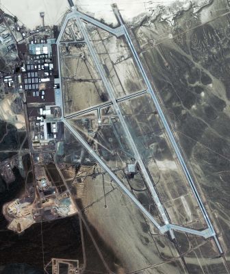
It is also known that the hangar doors in the sides of the mountains are closed when satellites pass overhead. The astronaut Gordon Cooper recently disclosed that pictures taken by him while orbiting in Gemini 5, were confiscated because he had been inadvertently traveling over Area 51 at the time. The base has the world’s longest runway, although the need for this is not clear unless landings from sub-orbital vehicles are necessary. None of this is visible to the public, as the surrounding vantage points in nearby mountains have been bought up and included within the perimeter of the vast site. Given the total paranoia surrounding the base and the activity that goes on there, the question is - what exactly is Area 51 and what happens there? The pictures below were taken in 1968 by the USGS (United States Geological Survey) and most recently in 2007 by Russia's Space Information KVR-1000 satellite system. Click on the picture for a larger version. |
|
| New Runway Added | |||
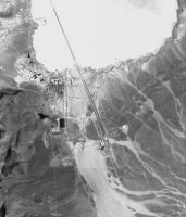 August 1968 |
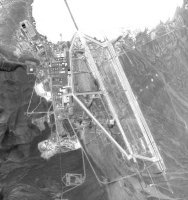 April 2007 |
One of the most obvious changes from 1968 to 2007 is the construction of a new 16,000 foot runway replacing the older 12,400 foot runway (R32). The old runway (now called Runway 32L) is on the west side of the base (north is at top), while the new runway is on the right. The southern end of the new Runway 32R is blackened with tire skid marks more than the northern end of the runway suggesting that the prevailing winds are from the north throughout most of the year. It is not clear how far on to the dry lake the Runway 32R overrun extends. At the south end of 32R there are six final flight check spaces on the runway apron. At each end of the runway there is a runway barrier net and arresting cable. | |
|
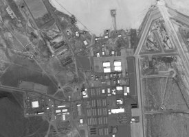
North Base |
|||
|
August 1968 |
April 2007 |
The four large hangars at the north of the base, present in the 1968 image, have evidently been enlarged by the time of the 2007 image. In addition, the housing complex for base personnel -- the large array of smaller buildings to the south of the hangars, has been entirely rebuilt between 1968 and 2007, with the addition of new support facilities. A B-52 aircraft is visible in the 1968 image. No aircraft are visible in the 2007 image. | |
|
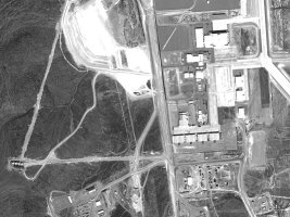
Southern Base Hangars |
|||
|
August 1968 |
August 2007 |
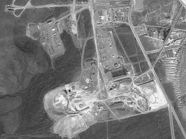
Perhaps the most significant
expansion in operational capabilities is noted in the southern part of the
base. The half dozen hangars present in the 1968 image are all evident
in the 2007 image, but the total number of hangars in this area has doubled
during the intervening years. The most noteworthy addition is
the hangar with the high peaked roof visible in the top of the 2007 image.
|
|
|
Tank Farm - South Base |
|||
 August 1968 |
 April 2007 |
The tank farm visible in the 1968 image, consisting of seven large storage tanks and three smaller tanks, remains visible in the 2007 image. The wide separation of the larger tanks is suggestive of fuel for aircraft. The 2007 imagery shows a large asphalt plant, that was used to construct the new runway. |
|
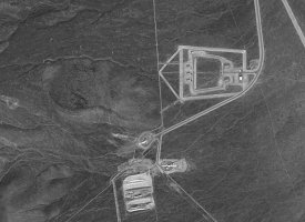
| New Construction - South Base | |||
|
August 1968 |
April 2007 |
Ikonos imagery has revealed that this 32 acre facility is a small weapons storage area with three small igloos and two larger igloos. | |
|
Various Images |
|||
|
|
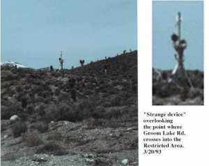
Strange device overlooking the point where Groom Lake Road crosses into the
restricted area. What is it used for? No one seems to know... |
||
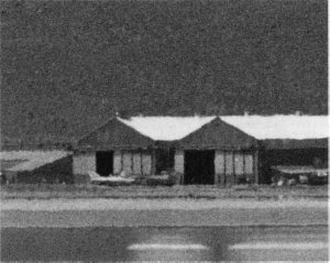
|
Are these regular airplanes in this hanger at Area 51? Perhaps they are super air/space craft based on newly "back-engineered" alien technology. | ||
|
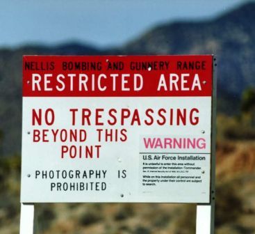
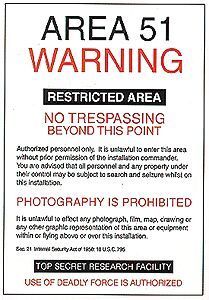
Warning signs that greet you on the road to Area 51.
|
Two aerial views of Area 51 showing the entire base (above ground). These pictures also show the longest runway in the world.
|
||
|
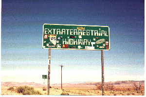
Picture of the ET Highway which passes through Rachel, Nevada.
|
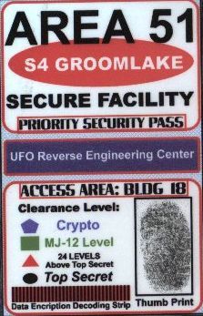
Area 51 entrance badge to underground engineering department.
|
What the Area 51 "Reverse Engineering" Scientists are working on as we speak!
|
|
|
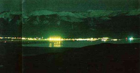
Area 51 at night.
|
|||
![]()
< Astronomy > < Website Directory >