![]()
|
Click on the graphics for larger version. For a printer friendly version, click here. |
|
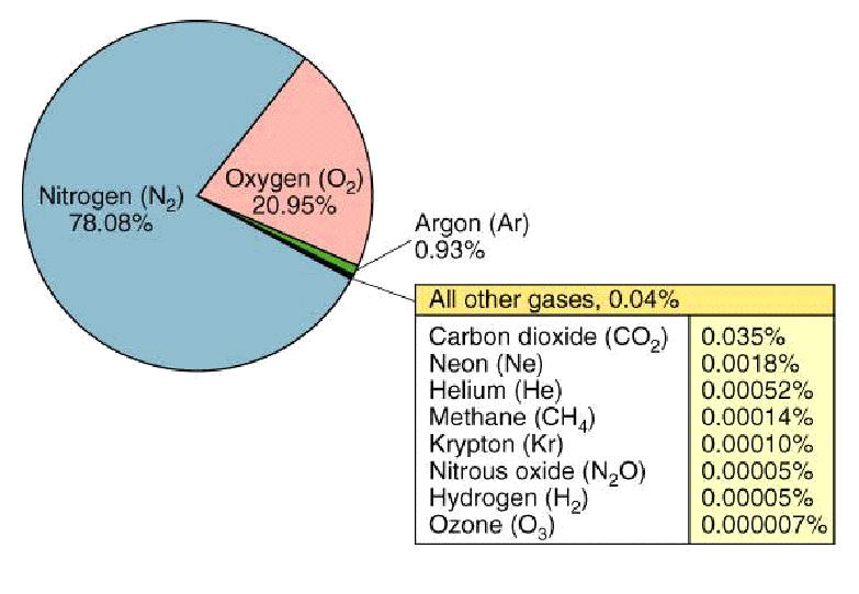
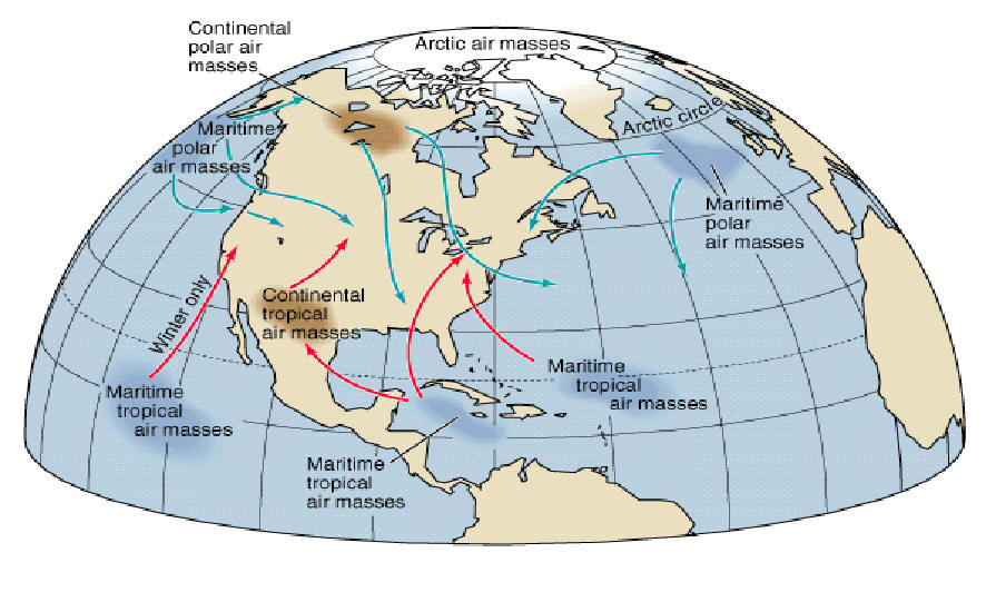
I) Observing Weather A) Properties of the Atmosphere 1) Mixture of gases (a) Nitrogen (b) Oxygen (c) Carbon dioxide (d) Ozone (e) Other trace gases 2) Reaches from Earth’s surface to edge of space 3) Resource (a) Life 4) Protection (a) Radiation (b) Temperature extremes 5) Layers of atmosphere (a) Troposphere (1) Closest to ground (b) Stratosphere (1) Contains ozone (i) Blocks harmful radiation (c) Mesosphere (1) Temperature decreases (i) Coldest spot in atmosphere (d) Thermosphere (1) Warmed by ultraviolet light (2) Ionosphere (i) Region where molecules have absorbed so much ultraviolet energy they become ionized B) Observing the Weather 1) Instruments (a) Temperature (1) Thermometer (b) Wind (1) Wind vane (i) Direction (2) Anemometer (i) Speed (c) Pressure (1) Barometer (d) Humidity (1) Hygrometers (i) Relative humidity 1. amount of water vapor in the air compared to the greatest amount the air can hold (e) Cloud cover (1) Measure as a percentage of the amount of sky covered by clouds (f) Precipitation (1) Precipitation gauge (i) Rain, snow, hail, sleet 2) Other instruments (a) Computers (b) Radiosonde (1) Measures weather conditions high above the ground (c) Radar (d) Satellites C) Reading Weather Data and Weather Patterns 1) Isobars (a) Lines connecting places of equal pressure 2) Isotherms (a) Lines connecting places of equal temperature 3) Air Masses (a) A large region of air with similar properties throughout (1) Maritime Polar (i) Cool and moist (2) Continental Polar (i) Cool and dry (3) Maritime Tropical (i) Warm and moist (4) Continental Tropical (i) Warm and dry 4) Fronts (a) Boundary between two different air masses (1) Cold front (i) Cold air moves in, pushing warm air above it (2) Warm front (i) Warm air moves in, pushing out cold air (3) Occluded front (i) One cold front overtakes a warm front and joins with another cold front (4) Stationary front (i) Front that does not move
|
Percentage of Various Gases in Air |
|||||||||||||||||||||
|
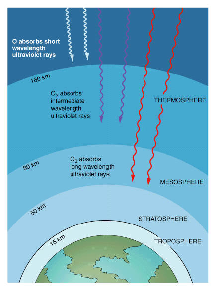
Life protecting layers of O, O2, and O3 in the atmosphere absorb lethal ultraviolet radiation.
|
||||||||||||||||||||||
|
The variation of temperature with altitude in the atmosphere The atmosphere is divided into four temperature zones. The outermost zone, the thermosphere, continues to an altitude of about 700 km. |
||||||||||||||||||||||
|
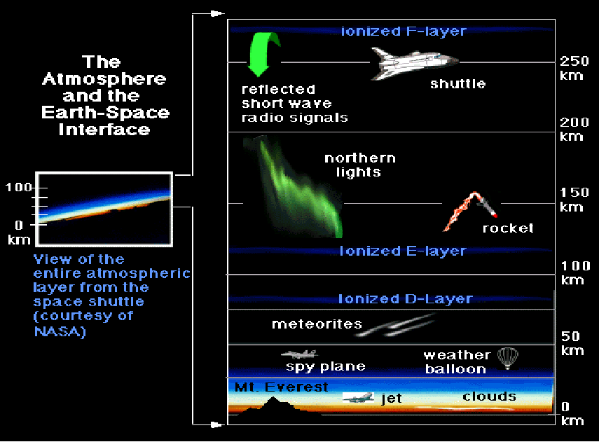
The Atmosphere and
Earth-Space Interface |
||||||||||||||||||||||
|
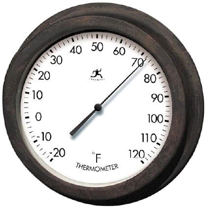
Thermometer
An instrument that
measures the temperature of a system in a quantitative way
Temperature
The temperature of
an object is that which determines the sensation of warmth or coldness
felt from contact with the object
|
||||||||||||||||||||||
|
Parts of a thermometer |
||||||||||||||||||||||
|
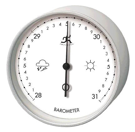
Barometer Measures the air pressure of the air that's pressing in all directions at ground level. The air's pressure is caused by the weight of all the air above the ground pressing down (caused by gravity). At sea level, air has a pressure of 14.7 pounds per square inch. Instead of using pounds per square inch, barometers in the U.S. measure the pressure in inches of mercury. This is how high pressure would push mercury into a tube that has the top sealed off from the air. A reading of 29.92 inches of mercury is the same as 14.7 pounds per square inch. |
||||||||||||||||||||||
|
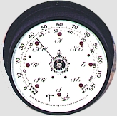
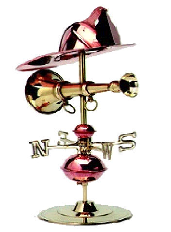
Anemometer Measures wind force and velocity |
Wind Vane Measures wind direction |
|||||||||||||||||||||
|
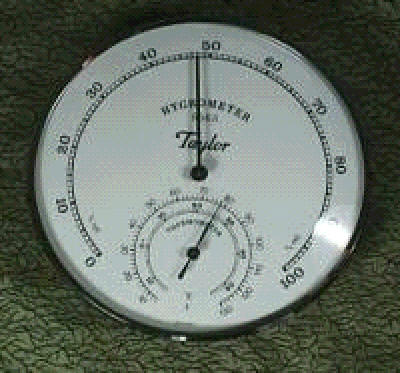
Hygrometer Measures relative humidity (amount of water vapor in the air compared to the greatest amount of water vapor it can hold) |
||||||||||||||||||||||
|
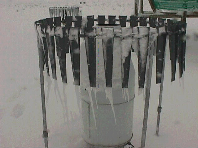
Precipitation Gauge Measurement of rain, snow, sleet and hail |
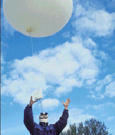 Radiosonde An instrument carried aloft, chiefly by balloon, to gather and transmit meteorological data. That's Eddie Friedmen (friend of mine) letting a weather balloon with a radiosonde loose. |
|||||||||||||||||||||
|
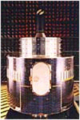
Meteosat A European weather satellite orbiting above the equator at an altitude of 23,000 miles. It takes a photo of the Earth every 30 minutes as well as sending back weather information and gathering data on the environment. |
||||||||||||||||||||||
|
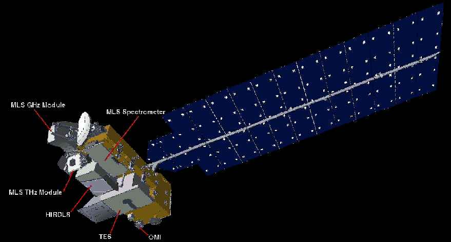
EOS Spacecraft This spacecraft repeats its ground track every 16 days. It provides atmospheric measurements over virtually every point on Earth in a repeatable pattern. This permits an ongoing assessment of atmospheric phenomena changes in the same geographic locations. |
||||||||||||||||||||||
|
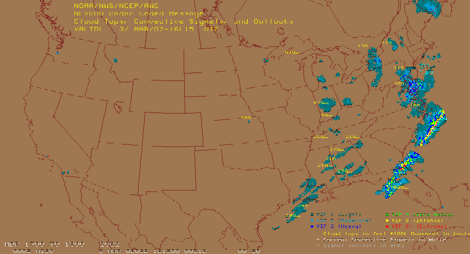
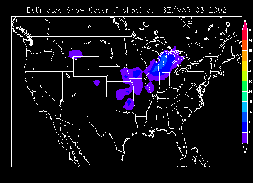
Various Radar Pictures |
||||||||||||||||||||||
|
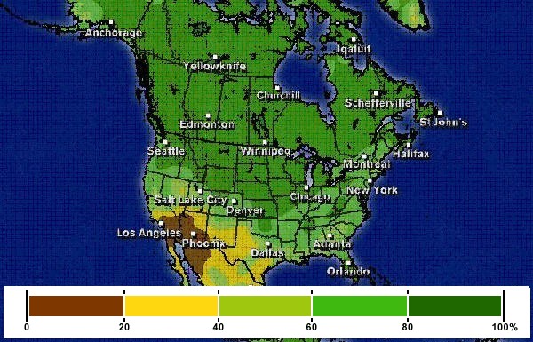
Weather Map showing relative humidity |
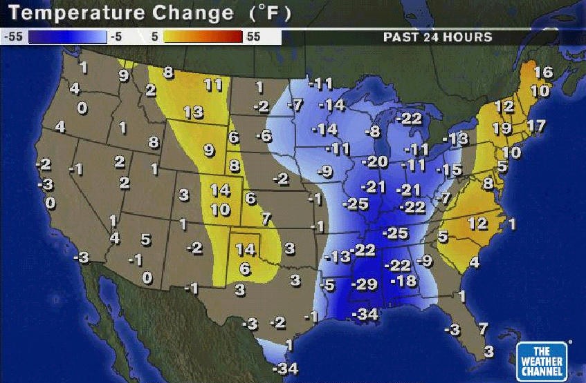
Weather Map showing temperature change |
Weather Map showing Isobars |
||||||||||||||||||||
|
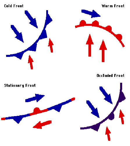
Fronts Zone of transition between two different air masses. Zone may be 20 miles across or 100 miles across. Significant different properties from one side of the front to the other include temperature, dew point, wind direction, cloud cover and on-going weather. |
Air Masses |
|||||||||||||||||||||
|
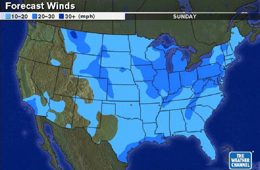
Weather Map indicating Wind Speed |
||||||||||||||||||||||
|
Cold Front Cold air moves in, pushing warm air above it. Characteristics of Cold Fronts
|
||||||||||||||||||||||
|
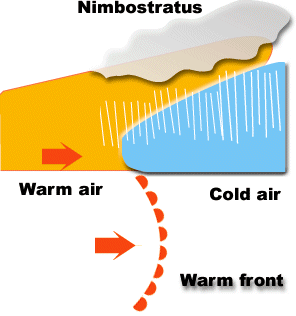
Warm Front Warm air moves in, pushing out cold air Characteristics of Warm Fronts
§
§
§
|
||||||||||||||||||||||
|
Occluded Front Formed when a cold front moves faster than a warm front; cold front catches up to and overtakes the warm front. Characteristics of Occluded Fronts
§
–
|
||||||||||||||||||||||
|
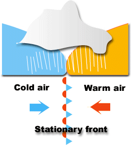
Stationary Front Does not move or barely moves Characteristics of a Stationary Front
|
||||||||||||||||||||||
![]()
< Weather & Climate > < Website Directory >